Search This Blog

Saturday, September 24, 2011

There's More To Australia Than Sydney, or Even Melbourne... Canyoneering With Mark Jenkins

© Carsten Peter/National Geographic. Cascades of mammoth ferns flourish in the humid air trapped between the narrow walls of Claustral Canyon.

Tuesday the new issue of National Georgaphic comes out with a fascinating essay by one of my favorite adventure travel writers, Mark Jenkins. His 1997 book, To Timbuktu was one of the inspirations for my own trip there two years ago. I doubt however, I'm up to following his trail into Australia's Blue Mountains. "The Swiss," he writes, "have mountains, so they climb. Canadians have lakes, so they canoe. The Australians have canyons, so they go canyoneering, a hybrid form of madness halfway between mountaineering and caving in which you go down instead of up, often through wet tunnels and narrow passageways."
Unlike other places with slot canyons, such as Utah, Jordan, or Corsica, Australia has a rich, deep heritage of canyoneering. In a way, it's an extreme form of bushwalking, something Aborigines were doing tens of thousands of years before Europeans arrived. But without ropes and technical equipment, Aborigines couldn't explore the deepest slots.

Today perhaps thousands of Aussies hike canyons, hundreds descend into them by ropes, but only a handful explore new ones. These driven individuals tend to have a rugby player's legs, knees crosshatched with scar tissue from all the scratches, a penguin's tolerance for frigid water, a wallaby's rock-hopping agility, and a caver's mole-like willingness to crawl into damp, dark holes. They prefer to wear Volleys-- canvas, rubber-soled Dunlop tennis shoes-- ragged shorts, ripped gaiters, and thrift-store fleece. They camp beside tiny campfires and make "jaffles" for breakfast, lunch, and dinner. Jaffles are sandwiches containing all manner of ingredients-- including Vegemite, a nasty-tasting yeast extract-- cooked inside fire irons over the flames. Above all they search for the most remote, difficult to access canyons. "The darker, the narrower, the twistier the better," says Dave Noble, one of the most experienced canyoneers in the country. "People say, What if you get stuck in there? But that's what you are after. To be forced to improvise to get yourself out."

His story in National Geographic is set about 4 hours west of Sydney in Kanangra-Boyd National Park and down the Mount Thurat fire trail and then up to the top of Danae Falls. He and his companion are traveling with wet suits, helmets, a rope, harnesses, and lunch in their packs. "It's like rappelling off the edge of a green-cloaked Grand Canyon," he writes.
The walls are covered with moss. Sliding to the inside of the giant stone turns out to be like squeezing into a narrow, ten-story elevator shaft pouring with water. We're forced to swing into the pounding waterfall, an awkward maneuver that slams us both into the rock. But it's worth it: Standing in a pool at the bottom, we easily pull our rope down.

Below the big boulder the slot closes up, and the silky water flows horizontally along the cavelike chamber back out to the edge of the cliff. We still have a thousand feet of air below us. We rappel directly into the bludgeoning waterfall. Halfway down I make the mistake of looking up, and the blast of water almost tears my head off.

The next three descents are just as extraordinary and drop us into hanging ponds of frigid water, like swimming pools midway up a skyscraper. We backstroke across these ponds, using the dry bags in our backpacks for flotation.

I like adventure travel-- a lot; this however is beyond my capacities these days. I'll stick with the thrill of reading about it in National Geographic... and hoping they filmed it and it winds up on TV. Canyoneering is popular in Tasmania too. Looks easy, doesn't it?

Sunday, September 18, 2011

Deadly Earthquake In Sikkim And Nepal


We are often speculating and ruminating about safety and dangers inherent in foreign travel. Somalia, Yemen and Nuevo Laredo are probably better left unvisited these days. Syria too. But how do you factor natural disasters like earthquakes into your travel plans. Today, for example, had you been walking by the British Embassy in Kathmandu, capital of Nepal, you might have been one of the 5 people killed by falling bricks when a disastrous earthquake struck on the Nepali-Sikkim border. Hundreds are injured and 18 are reported dead so far but the death total is expected to rise after the 6.8 magnitude quake.

Or you might have been walking along far from the quake, somewhere in northern India-- the whole region shook-- and been trampled by a panic-stricken mob... which is just what happened to a man in Bhagalpur in Bihar. And then there were the two persons were injured in Kathmandu's Central Jail when they tried to make their escape when the quake struck.

We were just in Nepal. The infrastructure-- like all of it-- is fragile and precarious... at best. And the quake rocked the whole country, which is historically marked by what various earthquakes have done in the past, but still totally unprepared for earthquakes from any perspective. Our favorite part of the trip-- aside from trekking in the mountains-- was our visit to Bhaktipur. Here's a photo from Bhaktipur I just found:


We'll update this post as more news comes in on the damage. Meanwhile, remember, disaster can strike almost anywhere. In March Kiplinger offered a list of the 10 American states most at risk of natural and unnatural disaster. It was done in terms of insurance risk but I guess you can take it into account when you make travel plans as well! Top on the list, predicatbly, are hurricane alley states, Louisiana, Florida, and Texas and #4 is New York (terrorist attacks), followed by-- back to hurricanes-- Mississippi. Now tornadoes and cyclones put Oklahoma at #6, tornadoes (no mention of domestic right-wing terrorism) and they close out with Alabama, California ("floods, earthquakes, landslides, tsunamis and strong Santa Ana winds that fuel wildfires"), Missouri, and Ohio ("more than 30 earthquakes between 2002 and 2007").

The death toll continues to rise and Monday morning there were 48 reported deaths throughout the region. Rescue operations are hampered by bad weather and impassable roads.

24 hours in and the latest death toll is 74 people in India, Nepal and Tibet. It's expected to continue rising as outside forces make their way to outlying regions.


UPDATE: Kathmandu Earthquake Risk Is Something To Take Into Consideration

I loved Kathmandu when I was there in 1971 and I was eager to go back. In the '90s it wasn't as good-- but which place ever is?-- but still fascinating enough for another trip. This summer I was back again-- and that was the last time. The pollution alone is enough to keep anyone sane away. And now scientists are warning that Kathmandu is "a high-risk city unprepared for the next 'Big One'."
Experts say Kathmandu is one of the most vulnerable cities in the world with an overdue earthquake predicted to kill tens of thousands of people and leave survivors cut off from international aid.

British geologist Dave Petley described the latest tremor, which killed eight people in Nepal, as a "wake-up call" for the overcrowded capital, home to two million people and connected to the outside world by just three roads and one airport runway.

...Nepal is a highly seismic region, lying above the collision of the Indian and Eurasian plates that created the Himalayas, and major earthquakes have hit the Kathmandu Valley every 75 years on average over recent centuries.

One quake destroyed a quarter of homes in Kathmandu 77 years ago, and geologists believe the area is at immediate risk of an 8.0-magnitude tremor-- ten times the size of last year's Haiti quake which killed more than 225,000 people.

Downtown Kathmandu is a maze of narrow, winding roads where rickshaws and cars jostle with cows to squeeze past dilapidated clay, brick and timber houses.

"The building stock is not seismically strengthened, suggesting that in a big earthquake there will be large numbers of building collapses," said Petley, of the Institute of Hazard, Risk and Resilience at Britain's Durham University.

GeoHazards International, a US-based research group, has measured the likely death toll from a quake of 6.0 magnitude or higher hitting cities in Asia and the Americas.
Kathmandu topped the list of 21 cities with 69,000 potential deaths, ahead of Istanbul and New Delhi.

The Kathmandu Valley has experienced rapid, uncontrolled urbanisation in the past few years and the lack of infrastructure and deep-rooted poverty leaves it desperately under-prepared for an earthquake, experts say.

Building codes are rarely enforced, few emergency drills are carried out, and the fact that Kathmandu lies on the site of a prehistoric lake filled with soft sediment also exacerbates the risk.

The one single-runway airport and all three access roads would likely be destroyed in a major quake, meaning the city could be stranded.


Friday, September 16, 2011

Mexican Gangsters Have A Warning For Bloggers


I was still a teenager when I started traveling abroad. My first trip was a harebrained decision to spend a summer hitchhiking to the North Pole with my lovely Alabama girlfriend Chris. We actually made it as far as Montreal. The next hitchhiking extravaganza was to Mexico City with my most adventurous school buddy, Robert. After all of our possessions were stolen by our host in San Antonio while we looked at the Alamo, we were assaulted by a knife wielding desperado at the Nuevo Laredo foot bridge who got Robert's watch. We still made it all the way to Mexico City!

I hadn't thought about that bridge, or Nuevo Laredo for that matter, in a number of decades... until this week. I just finished all the details of a trip to the Yucatán-- from renting a great house in Mérida to navigating the treacherous waters of airline booking. (I paid $540 directly on the Continental Airlines website after a Continental phone rep assured my-- several times-- that the cheapest tickets were $1,260.) This week something far worse than being robbed at knifepoint happened on that Nuevo Laredo bridge. The last time I wrote about Mexico it was to mention how safe the tourism bureau claims it is:
[W]e acknowledge there are some issues in some pockets, in some specific locations. To give you an example, Mexico has 2,500 counties. Eighty of those have issues. So does that mean that the entire country has issues? Of course not. Eighty of 2,500 is less than 5 percent. Ninety percent of Americans go to six destinations. The tourist destinations are very far from where we have these issues.

...For us in Mexico, when we talk about the U.S., we don’t say the U.S., we say Orlando, L.A., Washington. If something happened last week, if there was a shooting in East L.A., does that mean you can’t go to Washington? Of course not.

Apparently Nuevo Laredo is one of those pockets with issues.
Placards left with the tortured bodies of two people hanging from a Nuevo Laredo overpass warn that the same fate awaits social media devotees who keep information flowing by text, Twitter, blogs and other means as gangsters muzzle the news media in much of Mexico.

"This is going to happen to all the internet busybodies," said one of the notes signed with a Z, presumably for the Zetas gang that controls Nuevo Laredo. "Listen up, I'm on to you."

Many Mexican newspapers and broadcasters have self-censored under constant gangster siege. Reporters have been killed, newsrooms attacked. Government officials often prove less than forthcoming with timely and accurate information. Twitter, Facebook, blogs and text messaging all have filled the void, becoming primary news sources in scores of Mexican communities, even for family members in the U.S., as gangs battle cartel rivals and security forces.

The messages found in Nuevo Laredo on Tuesday, with the bodies of a man and a woman in their 20s, directly threatened two popular blogs that specialize in reporting gang-related violence.

A post on one of those blogs, Al Rojo Vivo, counseled readers on Wednesday, "Don't be afraid to inform ... It's very difficult that they know who is informing. They are only trying to frighten society." The blog is carried by the website of the Monterrey newspaper El Norte.

While valuable to many residents, social networkers also spread rumors that have panicked communities. Prosecutors last month jailed and charged two people [a math teacher and a grandmother] with "terrorism" for tweeting false reports of gangster attacks on schools in the Gulf Coast port of Veracruz.

Social media reports of other gangster attacks emptied the streets of Veracruz's capital, Xalapa, and other towns last weekend. Suggesting that the terrorism charges were overblown, Veracruz Gov. Javier Duarte nevertheless announced Tuesday that he would propose a new state law against "upsetting the public order."

But governments elsewhere have turned to social media in efforts to keep people informed. City officials in Reynosa, on the Rio Grande downriver from Nuevo Laredo, began tweeting several years ago to warn residents of gangster roadblocks and shoot-outs, blandly referring to them as "risky situations."

Early this year, mainstream media executives agreed with federal officials to scale back on coverage of the criminal slaughter that has killed more than 40,000 people in less than five years.

Many newspapers no longer print photographs of murder victims nor report the contents of threats or other messages left with bodies or in public places. Executives reason that publishing specifics-- including the beheading, dismembering or flaying of victims-- only encourages the gangsters and helps them spread their propaganda.

But Blog del Narco, the second site threatened by the Nuevo Laredo messages, religiously carries close-up shots of the carnage, as well as messages left with bodies or elsewhere. Many of the blog's anonymous posts seem likely to have been penned either by the gangsters themselves or investigating police.

The blog Wednesday published the text of a banner draped by a local criminal syndicate in the violent city of Apatzingan, in western Michoacan state. The sign warned residents to avoid Thursday night's public celebrations that kick off Mexico's Independence Day.

"Be alert for possible threats from the Zetas," reads the banner, signed by local gangsters who call themselves the Knights Templar. "Together we can guard our city and our people from persons who only want to cause harm."

Bloggers, of course, aren't the only people who need to be alert in regard to the Zetas. Yesterday they killed the family of a policeman in connection to the deadly fire-- 52 people died-- they had set at a casino in Monterrey August 25. Is Mexico becoming a failed state? Is it already a failed state?
The murder of the family came on a day of violence in and around Monterrey, in which at least 15 people were killed.

Monterrey and the state of Nuevo Leon have seen rising bloodshed as the Zetas and Gulf cartels vie for control of trafficking routes to the US.

The casino attack was one of the deadliest episodes of violence since President Felipe Calderon launched his crackdown on drug gangs in late 2006.

Gunmen burst into the crowded casino in broad daylight and doused it in petrol before setting it alight.

Panic ensued as people rushed for the exit. Many were overcome by smoke as the building was engulfed in flames.

The attack caused outrage in Mexico, a country that has become accustomed to drug-related violence, with around 40,000 killed in less than five years.

Saturday, September 10, 2011

Urban Gadabout reminder for NYers: James Renner's series of Northern Manhattan walks starts tomorrow (Sept. 11)

Morris-Jumel Mansion, on Jumel Terrace in Washington Heights

by Ken

For six Sundays at noon, starting tomorrow and running through October 16, the official historian of Manhattan Community District 12 is offering walking tours of selected locations in "WAHI," the Northern Manhattan neighborhoods of Washington Heights and Inwood, plus little Marble Hill, which on maps looks like it should be part of the Bronx but is actually part of Manhattan. (I listed the subjects of the individual tours in my last post on the subject.)
Sunday, September 11, 2011, 12:00 noon
JUMEL TERRACE HISTORIC DISTRICT & SUGAR HILL


JUMEL TERRACE HISTORIC DISTRICT & SUGAR HILL are noted for the Morris-Jumel Mansion, Sylvan Terrace and the moes of famous African American entertainers Paul Robeson, Count Basie and Duke Ellington at 555 Edgecombe Avenue. The area is home to a local bookstore and the Washington Heights branch of the New York Public Library. Nearby Coogan's Bluff is where baseball fans watched the New York Giants play at the Polo Grounds at 155th Street.

There is an admission fee to the Morris-Jumel Mansion; $5 for adults, $4 for seniors and students.

DATE: Sunday, September 11, 2011
TIME: 12:00 noon
MEET: 160th Street and St. Nicholas Avenue in front of the Library

I've been grappling with scheduling conflicts for a number of the six WAHI tours (which are $15, $10 for seniors and students) but have managed to keep tomorrow clear for this one, which syncs wondefully with the free "Highbridge Park Hike" -- essentially along the upper edge of Coogan's Bluff -- I did in July with expert urban geologist Sidney Horenstein. We started that walk at the lower edge of the park (and the bluff), on 155th Street opposite the northern edge of the famous northern Harlem enclave of Sugar Hill.
#

Tuesday, September 06, 2011

Maybe You'd Better Move That Trip To Bangkok Up A Little Sooner


Anyone who's been following this blog has probably noticed that I'm a big fan of Thailand. I gave up counting how many times I've been there after a dozen. Whenever we go to Asia, we always try to spend some time in Bangkok on the way there or on the way back, like we just did on our trip to Nepal a couple months ago. The people, the food, the varied cultural offerings make Thailand one of the world's-- if not the world's-- best tourist destinations. So I'm sure I wasn't the only person alarmed at the headline in today's Guardian proclaiming the risk of Bangkok sinking into the sea. No doubt Pat Robertson or Michele Bachmann will soon by croaking that it's God's punishment for a pervasive climate of tolerance there-- though no one seems to be addressing God's decision to burn down Texas, despite big-tent prayer events led by the state shaman, Rick Perry. But no matter the craziness of American right-wing politics, the gloomiest assessments are that parts of Bangkok will be underwater by 2030.

Driving into town from the new airport, I'm always struck by the number of new highrises that are always going up in Bangkok-- all those huge cranes... more than I've ever seen in an American city. It's almost like China! But then there are parts of Thornburi on the other side of the river, way up beyond where the tourist hotels are, where life is entirely on the water. We love spending days in longtail boats cruising the canals and getting into the slow pace of life in these parts of the city-- even though it feels like you're in the countryside. Regardless of delusional Republican Party ideology and their bizarre self-destructive dogma, Thai's know why their capital city is sinking.
Several factors – climate change, rising sea level, coastal erosion, shifting clay soil-- are threatening the great city on the Chao Phraya delta, founded in April 1782 by the first monarch belonging to the Chakri dynasty, still ruling today.

The population has greatly increased, with about 10 million people now living in the city and its suburbs. Even the weight of the skyscrapers, constantly on the rise in a conurbation in the throes of perpetual change, is contributing to Bangkok's gradual immersion. Much of the metropolis is now below sea level and the ground is subsiding by 1.5 to 5cm a year.

In the medium to long term more than 1m buildings, 90% of which are residential, are under threat from the rising sea level. In due course the ground floors of buildings could be awash with 10cm of water for part of the year, according to the Asian Institute of Technology.

In the port of Samunt Prakan, about 15 km downstream from the capital, the residents of detached houses along the river already spend several months a year up to their ankles in water.

A joint report published in December by the World Bank, the Asian Development Bank and Japan's International Co-operation Agency highlighted the threat from climate change to three Asian mega-cities: Bangkok, Ho Chi Minh City, and Manila.

Illegal tapping of groundwater is one of the causes of the capital's misfortunes, according to Jan Bojo, a World Bank expert based there. Not all the specialists endorse this view, but they do agree the situation is bound to deteriorate over the next few years. Smith Dharmasaroja, the head of the National Disaster Warning Centre, is predicting that by 2100 Bangkok will have become a new Atlantis. However gloomy this may seem, Dharmasaroja's forecasts are taken seriously. In the 1990s he predicted the fearful tsunami which devastated countries round the Indian Ocean in 2004.

Dharmasaroja maintains that "no decision has been taken" at government level "to stop the problem." And, he adds, if nothing is done Bangkok could be underwater by 2030.

One of the solutions he has suggested is to build a series of dykes along the coast of the Gulf of Thailand, a scheme which would cost well over $2bn. He says work should start immediately, otherwise it will be too late to halt the chain of events leading to disaster.

Anond Snidvongs, an oceanographer and specialist on climate-change impacts in southeast Asia, takes a more cautious line. "No one can predict how long it will take for Bangkok to be flooded and how this process will unfold," he says. He sees no point in building huge dykes. "The rise in sea level is not that great and climate change only plays a fairly small part-- about one-fifth-- in the current scenario," he adds.

"It's pointless," he stresses, "to try to protect the coastline which is being eroded by three to four centimetres a year. But there are plenty of other ways of combating flooding, such as better management of building land in the city."

Friday, September 02, 2011

Urban Gadabout: NY Transit Museum tours announced plus those "WAHI" Upper Manhattan tours

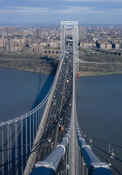
Wikipedia offers this view of Washington Heights beyond the George Washington Bridge, from the west. For a listing of historian James Renner's upcoming tours of the Northern Manhattan neighborhoods of Washington Heights, Inwood, and Marble Hill, see below.

by Ken

Since I last wrote, the New York Transit Museum tour schedule has been announced (you can find it on the Calendar of Events page of the website, and the early registration period for members is in full swing. As I mentioned, all the regular tours on the fall schedule are offered at least twice, and some of the especially popular ones, which in the past were generally already offered more than once, are offered even more often.

The four I pounced on start with two led by peerless "urban geographer" Jack Eichenbaum. With Jack you not only begin to understand why neighborhoods and regions have developed the way they have, but you see things you just wouldn't see with less tuned-in tour leaders.

PENN STATION "ECOLOGY"
Saturday, September 17, 10am-12n, and Sunday, October 9, 1-3pm
Constructed in a once squalid are known as the "Tenderloin," Penn Station united rails from Long Island, New Jersey and points south that previously terminated on the other side of the Hudson. Urban geographer Jack Eichenbaum will lead this walking tour through the remnants of the neighborhood's past and look at its proposed future, including the Farley Post Office building, the historic Hotel Pennsylvania, Herald Square, and "Koreatown."

LIFE ALONG THE L TRAIN
Saturday, October 15, 10am-1pm, and Saturday, November 19, 10am-1pm
Since its expansion to 8th Avenue in Manhattan in the 1930s, the L line has stimulated gentrification along its route. We will explore the West Village and Meatpacking District -- including a portion of the new Highline Park -- and on to Bushwick and Williamsburg, noting the continuous transformation of each of these neighborhoods.

By the way, Jack has announced some additional fall tours of his own, including an on-the-ground survey of the area he's currently watching with perhaps the greatest fascination, What's New in Long Island City? (Saturday, October 22, 11am-1pm) and one in his home area, which has already undergone an unrecognizable transformation, Religion on the Land: Polytheologic Flushing (Saturday, November 12, 12n-2:30pm). I've already done a fair amount of wandering in both Long Island City and Flushing with Jack, and I can assure you it's a special experience. (I would definitely do LIC with him again if I weren't already registered for the Municipal Art Society tour of the Chinatown-Little Italy Historic District at the same time.)

Jack also invites us to "hold the dates" for a pair of cold-weather tours ("both partially indoors"), with details to be announced: Keeping Off the Streets of Midtown Manhattan (East Side) (Saturday, December 3) and Flushing's Chinatown (Sunday, December 18).

The other two tours I couldn't resist are:

POWER UP! A SUBSTATION INSIDER
Saturday, November 5, 10am-12n, and Saturday, December 3, 10am-12n
As part of subway construction in 1904, the 59th Street Powerhouse was built to supply the massive amounts of power required to move trains and light tunnels in the new subway. Robert W. Lobenstein, former General Superintendent of New York City Transit, will take us inside magical Substation No. 13 and lead a sidewalk tour of the 59th Street Powerhouse.

MOVIN' ON UP: 75 YEARS OF SUBWAYS UNDER QUEENS BOULEVARD
Sunday, November 13, 11am-2pm, and Saturday, December 10, 11am-2pm
Seventy-five years ago the Independent Subway System was extended from Jackson Heights to Jamaica under Queens Boulevard, now a shopping mecca. Ridership at Forest Hills station now ranks 40th out of the system's 468 stations. Ride sections of this line and walk its surrounding neighborhoods with subway historian and retired LIRR manager Andrew Sparberg.

These are all $30 for NYTM members, $45 for nonmembers.

Two perennial favorites are offered four times each but are so popular that they're likely still to be tough to book.

At some point I will definitely do the CONEY ISLAND YARD tour again, and prepare for it better by schooling myself on the various kinds of subway cars that are serviced in this giant maintenance facility, and how exactly they work, to better appreciate this unparalleled close-up view of how that maintenance done. But the pièce de résistance is the visit to the tower where New York Transit personnel oversee the extraordinary coming together at Coney Island of four separate subway lines.

This is a must. It's being offered Tuesday evenings, 6-8:30pm, on September 13, October 11, November 8, and December 13 ($30 for members, $50 for nonmembers), and you're going to need photo ID -- they take security very seriously at the Coney Island Yard. (Anyone who didn't understand how essential the subways are to the life of the city got a demonstration when they were shutdown in anticipation of Hurricane Irene.)

The visit to THE JEWEL IN THE CROWN: OLD CITY HALL STATION is also enormously popular. When the old City Hall station was built, it was the anchor of the original subway line, and the station was built on a decorative scale that was never repeated. You're really traveling back in time here, and the station may be less "wow"-inspiring than you expected. (For one thing, it's not that large. The trains of the time were only five cars, cars that were much shorter than later ones.) But more than anything, you're seeing history here. The station was abandoned both because of lack of use and because the extreme track curve on which it sits could never have been adapted to handle the much larger, multiple-trains that became standard on the NYC subways.

You can glance at the station by staying on a no. 6 train after its last southbound stop at Brooklyn Bridge, when it makes the loop that turns brings it onto the northbound local track of the station -- and you are allowed to stay on the train, we were told, unless Transit personnel tell you the train is going out of service -- but you won't see much. The tour is the only way to get out onto the station platform and actually see what there is to see. This is the one NYTM tour that's members only, and may be itself be reason enough to join, though there seem to me plenty of other reasons, not least all those other tours. (Note that in addition to using my early-registration privilege, I paid $120 for my four tours, which for nonmembers would be $180.)

And oh yes, as I mentioned last time, there's one more of the museum's famous day-long NOSTALGIA RIDES, once again riding the old IRT lo-V cars up the Lexington Avenue line to Woodlawn Cemetery in the Bronx (Sunday, October 23, 10am-3pm; $35 for members, $50 for nonmembers). This time it's offered as a package deal with a box lunch and a tour of this final resting place of some of New York's Fanciest citizens (with cemetery architecture by some of New York's fanciest architects).

And I haven't even mentioned the museum itself, in downtown Brooklyn, which is terrific, both for its permanent exhibitions and the special ones offered for limited periods. (I was grateful at the two cracks that the summer Nostalgia Rides that departed from the museum gave me at the incredible exhibition on the Triborough Bridge, an amazingly thorough documentation with photos, archival documents, models, plans, etc. of how the concept for this complex of structures took shape and how it was executed, including what it displaced.)

Nor have I mentioned the numerous other special events, including all sorts for kids (many of whom are incredibly knowledgeable about the subways; at the Coney Island Yard, the youngsters on the tour knew everything about those trains!). Or the Museum Annex at Grand Central Station, which has free admission and is currently hosting an exhibition called "The Once and Future Penn Station." If you're visiting the city, you should definitely try to get to one if not both locations, and if you live here and haven't been yet, you really should go. For basic information, the Transit Museum website is a great starting place.


"WAHI" TOURS

Well, I've gotten my copy of James Renner's Washington Heights, Inwood, and Marble Hill, and it's a terrific book. But it didn't register for me before that it's part of the valuable Images of America series, which means it's basically a book of photos. There are lots of fine historical photos, informatively captioned, but alas no, it's no substitute -- as I was hoping -- for the tours I'll have to miss, owing to schedule conflicts, in this six-Sunday September-October series offered by the official historian of Manhattan Community District 12.

By way of overall introduction, James writes:
Washington Heights and Inwood (WAHI) are communities that have, over the years, gained recognition in massive demographic changes. People from other parts of the city are visiting and moving here because of its affordable housing and beautiful parks. These tours will demonstrate to the resident and visitor alike how upper Manhattan has changed and adapted to suit the needs of its new inhabitants and tourists.

You can find the full schedule with tour descriptions here. There are parts of the city it's easy to find covered by multiple walking tours; these aren't among them. The tours on the schedule ($15, $10 for students and seniors) are:

JUMEL TERRACE HISTORIC DISTRICT & SUGAR HILL (Washington Heights)
Sunday, September 11, 12n (additional fee for Morris Jumel Mansion admission)

COLUMBIA UNIVERSITY MEDICAL CENTER (Washington Heights; 165th to 168th, Broadway to Haven Avenue)
Sunday, September 18, 12n

FORT GEORGE (Washington Heights; 190th to 193rd, Amsterdam and Audubon Avenues)
Sunday, September 25, 12n

SHERMAN CREEK (Inwood)
Sunday, October 2, 12n

TUBBY HOOK (Inwood; Dyckman Street, Riverside Drive and Broadway)
Sunday, October 9, 12n

MARBLE HILL
Sunday, October 16, 12n
#

Thursday, September 01, 2011

Mérida And The Yucatán Peninsula Seem Safe Enough


We love Mexico. I started going when I was a teenager and I've always found the country awesome and inspiring and beautiful. I love the food and the folks have been kind. Mexico City is a terrific, cosmopolitan megapolis, as is Guadalajara and villages I've been to like San Miguel de Allende have been stupendous. Right now Roland, Helen, Michael and I are trying to decide between Mérida on the Yucatán Peninsula or Oaxaca on the other side of the country for a winter getaway. (And, to make it a little more complicated, Roland threw in the picturesque old colonial city of Cuernevaca in the country's heartland.)

We found a beautiful house to rent in Mérida and I'm really leaning that way right now. All the tour books give the place a big thumbs up. It's filled with gardens and plazas that give it a relaxed, tropical atmosphere and it boasts the oldest cathedral on the continent, built between 1561 and 1598, with stone walls from the ruined buildings of Tihó, the former Mayan city. In fact Mérida is right in the middle of the old Mayan Empire and there are ruins to visit all around, including some really close ones like Dzibilchaltún, founded in 500 BC, just 9 miles away. It covers around 6 square miles and since being rediscovered in 1941 something like 8,000 buildings have been mapped. Still close enough for a day trip are the even more outstanding Mayan ruins at Uxmal, Tulum and Chichén Itzá.

Lately there have been safety concerns in Mexico. But not really in the Yucatán. Last month Mexican Tourism Secretary Gloria Guevara was in the U.S. trying to reassure American tourists-- and U.S. visitors make up 60% of Mexico's tourism visitors-- that, despite warnings from the State Department, most of the country is safe.
[W]e acknowledge there are some issues in some pockets, in some specific locations. To give you an example, Mexico has 2,500 counties. Eighty of those have issues. So does that mean that the entire country has issues? Of course not. Eighty of 2,500 is less than 5 percent. Ninety percent of Americans go to six destinations. The tourist destinations are very far from where we have these issues.

...For us in Mexico, when we talk about the U.S., we don’t say the U.S., we say Orlando, L.A., Washington. If something happened last week, if there was a shooting in East L.A., does that mean you can’t go to Washington? Of course not.